News | September 22, 2021
NASA Finds 2021 Arctic Summer Sea Ice 12th Lowest on Record
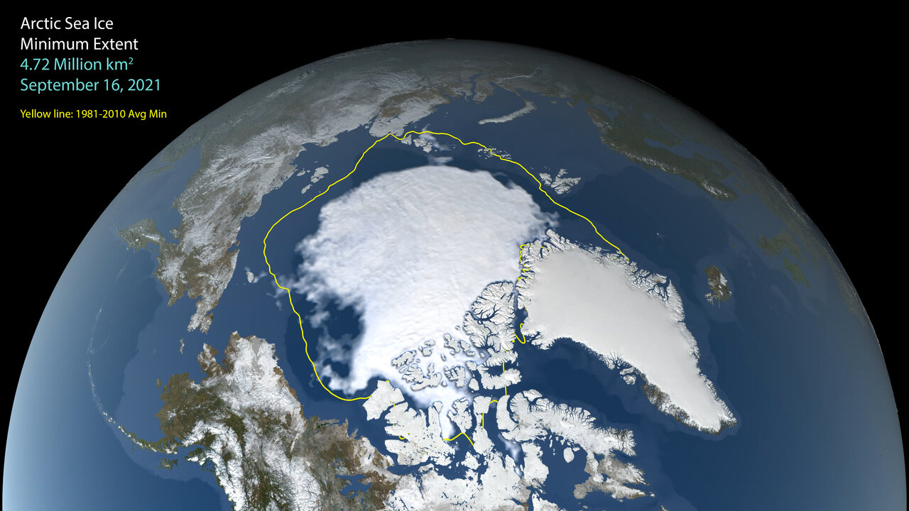
A still image visualizing Arctic sea ice on Sept. 16, 2021, when the ice appeared to reach its yearly minimum extent. On this date, the extent of the ice was 4.72 million square miles (1.82 million square kilometers). Credit: NASA's Scientific Visualization Studio
Sea ice in the Arctic appears to have hit its annual minimum extent on Sept. 16, after waning in the 2021 Northern Hemisphere spring and summer. The summertime extent is the 12th lowest in the satellite record, according to scientists at the NASA-supported National Snow and Ice Data Center and NASA.
This year, the minimum extent of Arctic sea ice dropped to 4.72 million square kilometers (1.82 million square miles). Sea ice extent is defined as the total area in which ice concentration is at least 15%.
The average September minimum extent record shows significant declines since satellites began measuring consistently in 1978. The last 15 years (2007 to 2021) are the lowest 15 minimum extents in the 43-year satellite record.
This visualization above, created at NASA’s Goddard Space Flight Center in Greenbelt, Maryland, shows data provided by the Japan Aerospace Exploration Agency (JAXA), acquired by the Advanced Microwave Scanning Radiometer 2 (AMSR2) instrument aboard JAXA’s Global Change Observation Mission 1st-Water “SHIZUKU” (GCOM-W1) satellite.


