NASA
Global Climate Change
Vital Signs of the Planet
Skip Navigation
menu close modal

Email sent. Thanks for your feedback.

Latest Resources

  • Video: Global Warming from 1880 to 2022
    Video: Global Warming from 1880 to 2022
  • Video: Annual Arctic Sea Ice Minimum 1979-2022 with Area Graph
    Video: Annual Arctic Sea Ice Minimum 1979-2022 with Area Graph
  • Video: Ozone Watch 2018
    Video: Ozone Watch 2018

Recent News & Features

A new NASA Climate feature series examines some of the lesser-known, and often surprising, ways global climate change is affecting our world. First up: transportation.
More
Planes, Shipping Lanes, and Automobiles: Surprising Ways Climate Change Can Affect Transportation
features
Planes, Shipping Lanes, and Automobiles: Surprising Ways Climate Change Can Affect Transportation
From space, air, and on the ground, NASA studies Earth and the ways it is changing. These observations help us better understand – and prepare for – the effects of human-caused global warming. Today, the agency released its 2023 climate strategy.
More
NASA Releases Agency Climate Strategy
features
NASA Releases Agency Climate Strategy
NASA’s Images of Change gallery has added a new feature: "Google Timelapse" view. In addition to comparison views of before-and-after images, you can now view selected scenes as time-lapse sequences generated via the Google Earth engine.
More
Explore Time-Lapse Views of Our Changing Planet
features
Explore Time-Lapse Views of Our Changing Planet
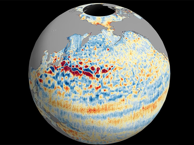
The Surface Water and Ocean Topography mission offers the first taste of the detailed perspectives of Earth’s surface water that its cutting-edge instruments will be able to capture.
More
Joint NASA, CNES Water-Tracking Satellite Reveals First Stunning Views
Observations from space show that the rate of sea level rise is increasing. Knowing where and how much rise is happening can help coastal planners prepare for future hazards.
More
NASA Uses 30-Year Satellite Record to Track and Project Rising Seas
features
NASA Uses 30-Year Satellite Record to Track and Project Rising Seas
A pilot project has estimated emissions and removals of carbon dioxide in individual nations using satellite measurements.
More
NASA Space Mission Takes Stock of Carbon Dioxide Emissions by Countries
features
NASA Space Mission Takes Stock of Carbon Dioxide Emissions by Countries
NASA scientists have mapped almost 10 billion individual trees in Africa’s drylands to assess the amount of carbon stored outside of the continent’s dense tropical forests.
More
NASA-Funded Scientists Estimate Carbon Stored in African Dryland Trees
features
NASA-Funded Scientists Estimate Carbon Stored in African Dryland Trees
Mangroves help protect against the effects of climate change in low-lying coastal regions. NASA and partners are using satellite data to monitor the health of these ecosystems so local experts can respond.
More
A Health Check for South American Mangroves
Earth Science in Action
A Health Check for South American Mangroves
This source accounts for about 10% of all the water that enters this highly productive farmland, including rivers and rain.
More
NASA Measures Underground Water Flowing From Sierra to Central Valley
features
NASA Measures Underground Water Flowing From Sierra to Central Valley
Earth's average surface temperature in 2022 tied with 2015 as the fifth warmest on record, according to an analysis by NASA.
More
NASA Says 2022 Fifth Warmest Year on Record, Warming Trend Continues
news
NASA Says 2022 Fifth Warmest Year on Record, Warming Trend Continues
Extreme rainfall during Tropical Storm Nalgae (locally called Paeng) on Oct. 29, 2022, caused destructive flooding and landslides in the southern Philippines.
More
Tropical Storm Nalgae Floods the Philippines
images of change
Tropical Storm Nalgae Floods the Philippines
A warming planet is leading to more frequent and intense rainfall, causing more landslides. A team of master’s students came up with a novel approach to helping NASA study these events on a large scale.
More
Using Reddit to Detect Landslides
Earth Science in Action
Using Reddit to Detect Landslides

Get the Newsletter

Stay Connected

Facts

    • Evidence
    • Causes
    • Effects
    • Scientific Consensus
    • Global Warming vs. Climate Change
    • Vital Signs
    • Questions (FAQ)

News

    • News and Features
    • Ask NASA Climate
    • Subscribe
    • Climate Newsletter Archive

Solutions

    • Earth Science in Action
    • Mitigation and Adaptation
    • Sustainability and Government Resources

Explore

    • Images of Change
    • Earth Minute Videos
    • Interactives
    • Beautiful Earth Gallery
    • Earth 360

NASA Science

    • Science Mission Directorate
    • NASA Data Resources
    • Earth System Science
    • Earth Science Missions
    • History
    • People

More

    • For Media
    • For Educators
    • Multimedia
    • En español
    • For Kids
    • About Us
  • Feedback
  • |
  • Awards
  • |
  • Sitemap
  • |
  • Earth Observatory
  • |
  • SEA LEVEL CHANGE
  • |
  • Privacy
  • |
  • Climate Data Initiative
  • |
  • U.S. CLIMATE RESILIENCE TOOLKIT

This website is produced by the Earth Science Communications Team at

NASA's Jet Propulsion Laboratory | California Institute of Technology

Site Editor: Holly Shaftel
Managing Editor: Susan Callery
Senior Producer: Randal Jackson
Senior Science Editor: Daniel Bailey
Science Editor: Susan Callery

Site last updated: March 31, 2023