Ask NASA Climate | May 10, 2010, 17:00 PDT
Pick of the pics
Can't pronounce its name, but can see it from space

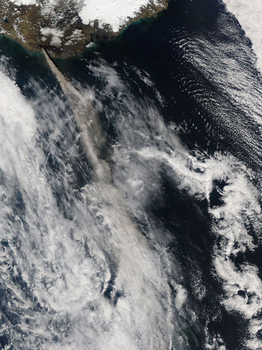
Credit: NASA Goddard / MODIS Rapid Response Team.
After more than a week of relatively subdued activity in late April 2010, Iceland’s Eyjafjallajokull Volcano began a fresh round of explosive ash eruptions in the first week of May. On May 10, 2010, the Moderate Resolution Imaging Spectroradiometer (MODIS) onboard NASA’s Aqua satellite captured this view of a thick plume of ash blowing east and then south from the volcano (top left). The ash plume can be seen streaming in a straighter, more steady path than the day before, indicating winds were stronger than they were on May 9. Farther south in the image the ash plume has become partially obscured by higher clouds (white). By May 10, the ash had reached North Africa, Turkey and Morocco.
Caption courtesy of NASA's Earth Portal.
