Ask NASA Climate | August 24, 2009, 17:00 PDT
Pick of the pics
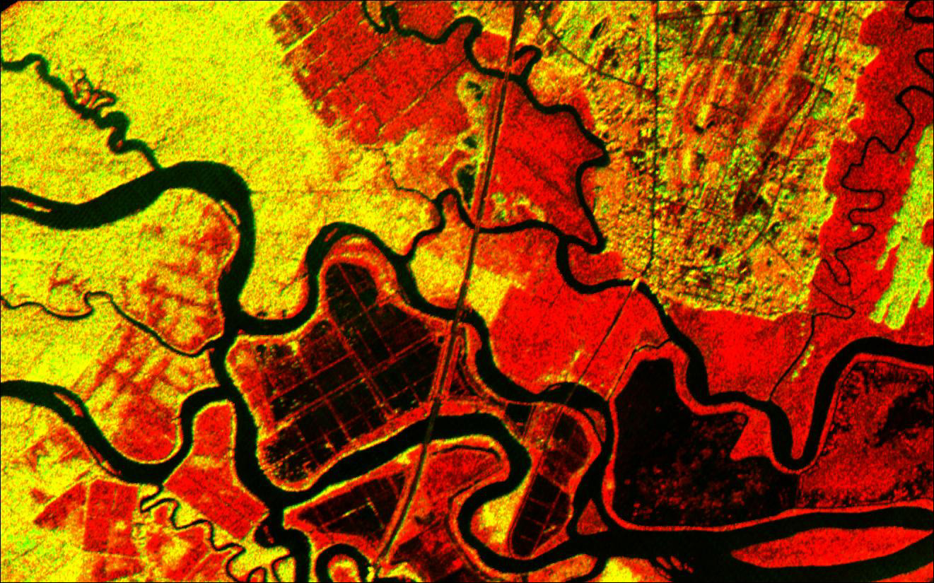
Altamaha River delta, Georgia coast

Courtesy of NASA/Jet Propulsion Laboratory/University of Edinburgh.
The Altamaha River delta found at the mouth of Georgia’s largest river has a long history of agricultural development, which dates back to the founding of the Georgia Colony in 1733. In this image, taken by NASA’s Airborne Synthetic Aperture Radar (AIRSAR) during a 1994-1995 data collection campaign, the outlines of long-lost plantation rice fields, canals, dikes and other inlets are clearly defined. Salt marshes are shown in red, while dense cypress and live oak tree canopies can be seen in yellow-green hues. The plantation system ended with the American Civil War of the 1860s. Today, the delta attracts flocks of endangered birds such as the American oystercatcher, thanks to its abundant food supply, shelter and nesting grounds.
