Ask NASA Climate | January 2, 2011, 16:00 PST
Pick of the pics
Meandering along
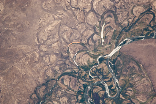
Credit: The Gateway to Astronaut Photography of Earth, Astronaut photograph ISS022-E-19513. Caption adapted from the Gateway webpage
This photo, taken by the Expedition 22 crew onboard the International Space Station a year ago, shows the Rio Negro, one of the most meandering rivers in South America.
The river generally flows southeast from the Andes Mountains to the Atlantic Ocean. Its floodplain, which is about 10 kilometers wide, supports the biggest pear- and apple-growing region of Argentina. During the 1800s, the river was also the demarcation line between farmlands of European settlers and territory controlled by indigenous people.
The Rio Negro is a dramatic example of how mobile a river can be. Its floodplain is covered with curved relicts of channels known as “meander scars”. Meander scars show where the river used to snake and bend in the recent geological past, in this case probably during the last few hundred years.