Ask NASA Climate | October 16, 2018, 08:14 PDT
Students traverse land, air and water in Canada with a NASA mission to study climate change
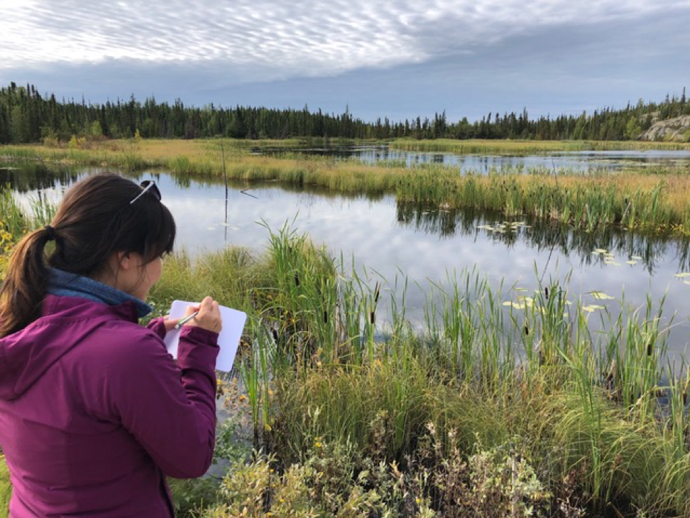
Joanne Speakman helps scientists map wetlands near the city of Yellowknife in the Northwest Territories, Canada. Credit: Paul Siqueira
My name is Joanne Speakman, and I’m from the Northwest Territories (NT) in Canada. I’m indigenous to the Sahtu Region and grew up in Délįne, a beautiful town of about 500 on Great Bear Lake. Now I live in Yellowknife, NT, and study environmental sciences at the University of Alberta.
I was a summer student this year with the Sahtu Secretariat Incorporated (SSI), an awesome organization in the NT that acts as a bridge between land corporations in the Sahtu. My supervisor, Cindy Gilday, helped organize a once-in-a-lifetime opportunity for me and a fellow student from Délįne, Mandy Bahya, to fly with NASA. It was a dream come true.
One of NASA’s projects is called the Arctic-Boreal Vulnerability Experiment (ABoVE), which is studying climate change in the northern parts of the world. People from the circumpolar regions have seen firsthand how drastically the environment has changed in such a short period of time, especially those of us who still spend time out on the land.
Weather has become more unpredictable and ice has been melting sooner, making it more difficult to fish in the spring. Climate change has also contributed to the decline in caribou, crucial to Dene people in the north, both spiritually and for sustenance.
Studies like ABoVE can help explain why and how these changes are happening. Along with traditional knowledge gained from northern communities, information collected by ABoVE can go a long way in helping to protect the environment for our people and future generations.
Wednesday, August 22, 2018

It was exciting to meet the ABoVE project manager, Peter Griffith, and the flight crew because it’s amazing what they do, and to fly with them was an incredible opportunity to learn from one another. Although we were from different parts of the world, at the end of the day we are all people who care about taking care of the environment.
We flew on a Gulfstream III jet to survey the land using remote sensing technology. We flew from Yellowknife to Kakisa, Fort Providence, Fort Simpson and then back to Yellowknife.
During the flight, crew ran the remote sensing system and they explained to us how it works. It got complicated pretty quickly, but from what I understood, a remote sensor is attached to the bottom of the plane and sends radio waves to the ground and bounce back, providing information about the land below and how it is changing from year to year.


August 24, 2018
NASA’s also working on building a satellite called the NASA-ISRO Synthetic Aperture Radar, or NISAR, which will help study the effects of thawing permafrost. Two of the lead scientists working on NISAR are Paul Siqueira and Bruce Chapman. While they were in Yellowknife, Mandy and I got invited to join them for a day to help collect field data.

We met with Paul and Bruce early in the morning and then drove out on the Ingraham Trail until we reached a small, marshy lake. We got out and walked along the lake’s edge, making measurements of the amount of marshy vegetation from the shore to the open water, an area that I learned is called inundation.
We used our own estimations and also a cool device that uses a laser to tell you exactly how far away an object is. Paul and Bruce will use the information we collected that day to figure out the best way to map wetlands, which will help the ABoVE project study permafrost thaw and help with development of the NISAR satellite by comparing our results to satellite images of the area.

In the afternoon, we surveyed a second lake, this time using a canoe. The sun came out and we saw ducks, a juvenile eagle, and many minnows swimming around. Nothing’s perfect, but this day was close to it and we learned a lot along the way.
Meeting and spending time with the NASA team, especially Bruce, Paul, and Peter, was the highlight of the two days. They’re incredibly kind and thoughtful and took the time to share their knowledge with us. ABoVE is a 10-year program and I hope there will be many more opportunities for northern youth to participate in such an exciting, inspiring project. There is so much potential out there. Thanks again for an amazingly fun learning experience!
This piece was originally published on the NASA Earth Expeditions blog.