Ask NASA Climate | January 19, 2016, 05:19 PST
Measuring global sea level: It's a long-term relationship kind of thing

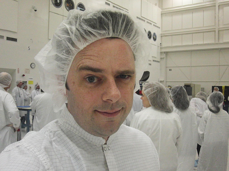
Dr. Josh Willis, lead project scientist for the Jason-3 mission, wears a bunny suit in JPL's clean room where the instrument was built.
“The moment the satellite separated from the rocket got me feeling emotional,” Dr. Josh Willis, lead project scientist for the Jason-3 mission, told me. I imagined the satellite emerging from the nosecone of SpaceX’s Falcon 9 rocket and unfurling its solar panels 830 miles above where we were standing near the bar at the Jason-3 launch after-party. Seeing a NASA science dude with a crisp shirt, black suit jacket and—can you believe it—cufflinks was heartwarming. I recognized his dad, his wife, his in-laws nearby. My husband was there, too, along with most of our peers, all part of an odd little NASA ocean sciences extended family.
When Willis told me he “had affection” for the Jason-3 satellite, I felt relief; glad that I wasn’t the only one who’d been anthropomorphizing. He said that the French engineers from CNES, the French Space Agency, who were responsible for connecting the satellite to the rocket, had drawn a pair of eyes on the nitrogen storage bags used for sealing the satellite to prevent rust. “It looked like it was alive,” he said.
Unless you’re a total whack, your affection for flight hardware builds up over time. And Willis’ work with satellites that measure sea surface height goes back to TOPEX/Poseidon, the great granddaddy of ocean surface topography, which launched in 1992 when he was a graduate student. “Back then, the data was cool and interesting and was really accurate. It did what it was supposed to do, which was amazing to me.” TOPEX/Poseidon was originally designed as a 5-year mission to measure currents. “In the beginning, it wasn’t obvious that these satellites would measure climate change. It took years to ensure that the satellites were accurate enough to measure global sea level change, and, of course, now they’re the most important tool for measuring global warming.”
After 23 years of data, we’re continuing the series with the launch of Jason-3, the fourth member of the family. “That’s a huge triumph of science and engineering,” he explained. “NASA always wants to do new things, but for climate science, we really need to do the same thing over and over. That’s a different type of job.” I looked around at our spouses and thought about how I explain marriage to my single friends: You can get a lot of interesting things from a long-term commitment. Willis agreed. It’s a whole career, going the distance, not just one conquest after the other.
“It took years and years for the entire science team, which is a couple hundred people looking at this data year in and year out, to feel confident that we were measuring more than currents. Everything has to be perfect to measure global sea level rise.” And over that 23-year period, while the scientists’ abilities to use the data improved, global sea level rose an inch or two, which, sad but true, made it easier to measure.
Jason-3 launched just in time to observe the 2016 El Niño with its many extreme sea levels, storms and high winds in the ocean. The Jason-2 and Jason-3 satellites will fly right next to each other, separated by 60 seconds, and the calibration will happen over a wide range of different conditions. When I asked Willis if this year’s El Niño is bigger than the one in 1997-98, he said, “The water at its peak temperature in the Pacific this time is warmer than the peak temperature in 97-98. But what most people care about is rainfall, and by that measure, we’ll just have to wait and see. We’ve got a few more months before El Niño clobbers us here in the U.S. Plus, we’ve had another 18 years of global warming.”
“Let’s face it, the ocean dominates everything,” he continued. “Two-thirds of the planet’s surface is rising. That’s the story of global warming. You have to have a satellite to see that, and the Jasons do what nothing else can.”
As always, I welcome your comments.
Laura
TOPEX/Poseidon and Jason-1 were cooperative missions between NASA and the French space agency, CNES. Additional partners in the Jason-2 mission included NOAA and Eumetsat. Jason-3 continues the international cooperation, with NOAA and Eumetsat leading the efforts, along with partners NASA and CNES.
