Ask NASA Climate | October 12, 2009, 17:00 PDT
Pick of the pics
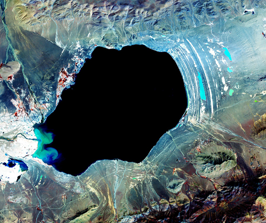
Into the abyss: Dagze Co, Tibet
Courtesy of NASA/Goddard Space Flight Center, Japan's Ministry of Economy, Trade and Industry, Japan's Earth Remote Sensing Data Analysis Center, the Japan Resources Observation System, and the U.S./Japan ASTER Science Team.
Dagze Co is one of many inland lakes in Tibet, with an area of about 260 square kilometers (100 square miles). In glacial (ice age) times, the region was considerably wetter, and lakes were correspondingly much larger. The numerous concentric rings that circle the lake are fossil shorelines, and attest to the presence of a larger, deeper lake in the past. Climate change since then has caused the Tibetan Plateau to become more arid, and its lakes to dry up. The picture was taken by the Advanced Spaceborne Thermal Emission and Reflection Radiometer (ASTER) aboard NASA’s Terra satellite on October 8, 2001.