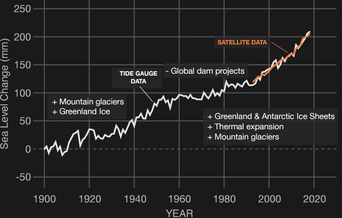
SOURCE DATA: 1900-2018
Credit: NASA’s Goddard Space Flight Center/PO.DAAC

Sea level rise is caused primarily by two factors related to global warming: the added water from melting ice sheets and glaciers, and the expansion of seawater as it warms. The first graph tracks the change in global sea level since 1993, as observed by satellites.
The graph on the left, which is from coastal tide gauge and satellite data, shows how much sea level changed from about 1900 to 2018. Items with pluses (+) are factors that cause global sea level to increase, while minuses (-) are what cause sea level to decrease. These items are displayed at the time they were affecting sea level.