Arctic Sea Ice Minimum Extent
Arctic sea ice reaches its minimum extent (the area in which satellite sensors show individual pixels to be at least 15% covered in ice) each September. September Arctic sea ice is now shrinking at a rate of 12.2% per decade, compared to its average extent during the period from 1981 to 2010. This graph shows the size of the Arctic sea ice each September since satellite observations started in 1979. The monthly value shown is the average of daily observations across the month of September during each year and is measured from satellites.
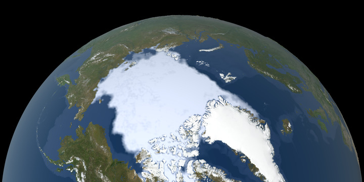
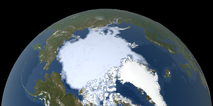
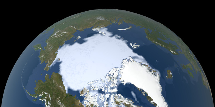
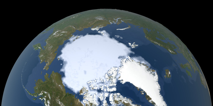
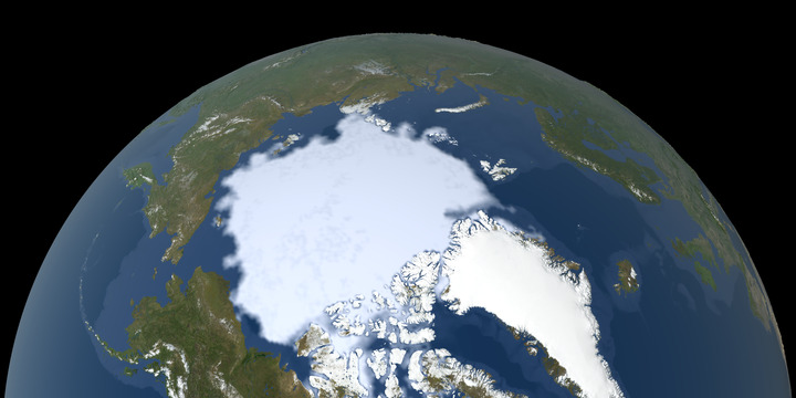
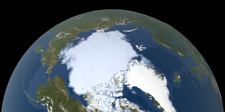
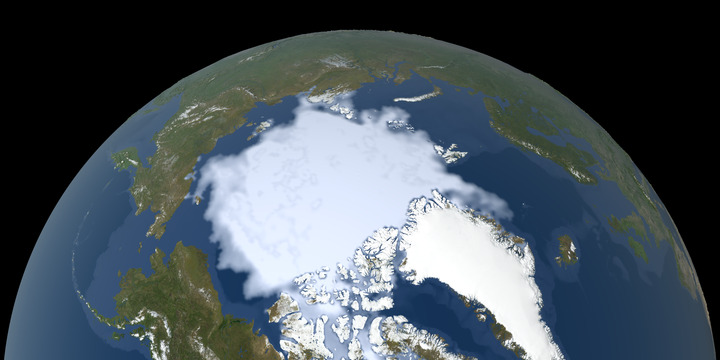
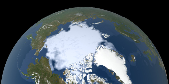
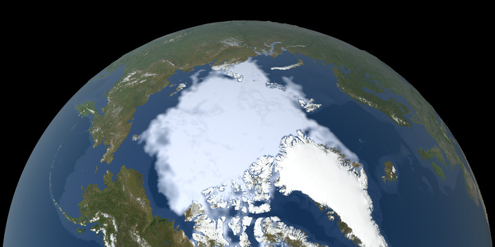
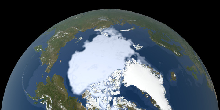
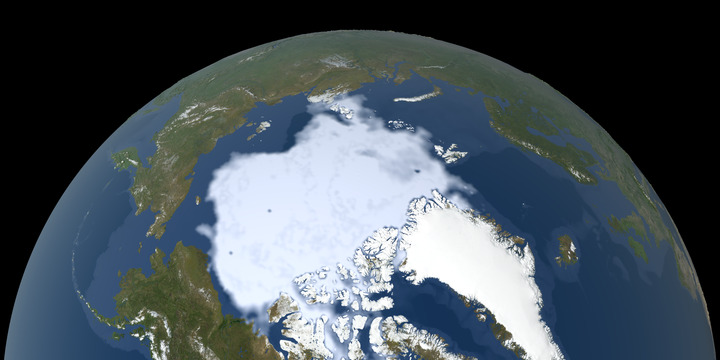
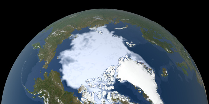
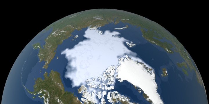
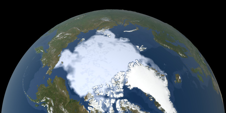
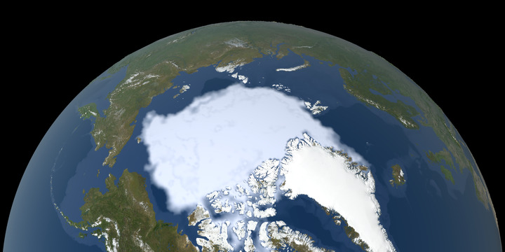
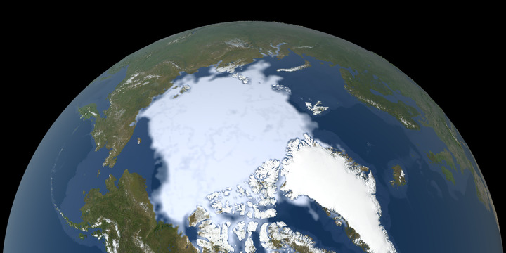
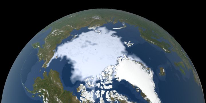
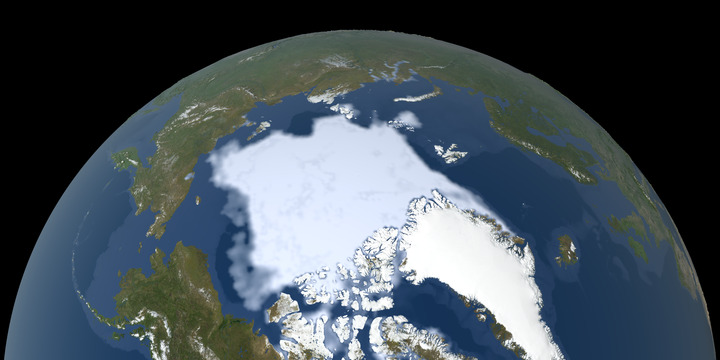
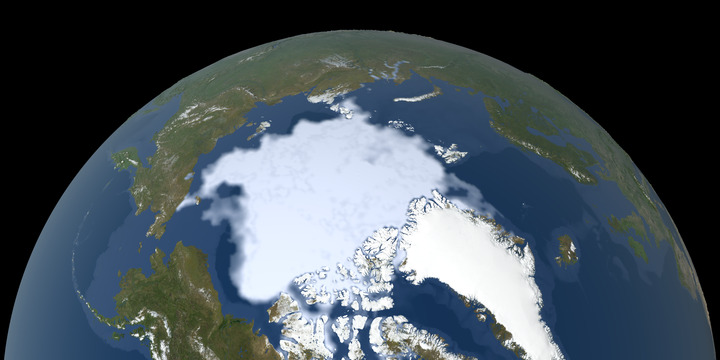
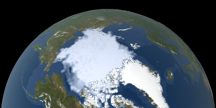
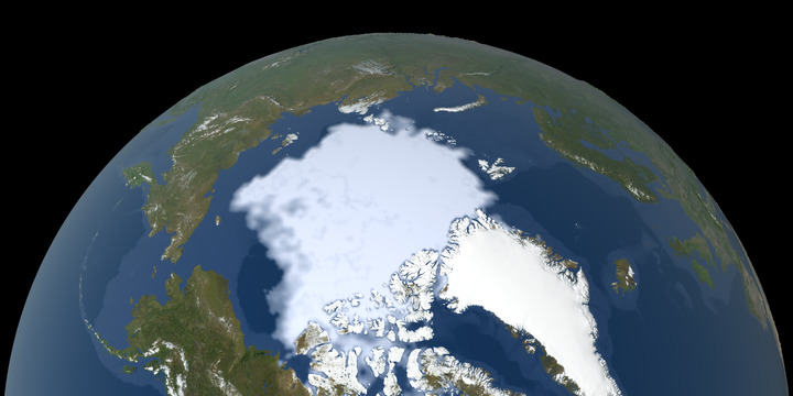
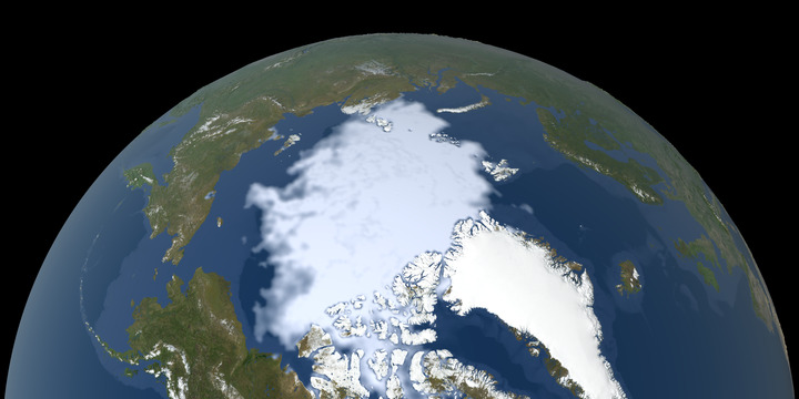
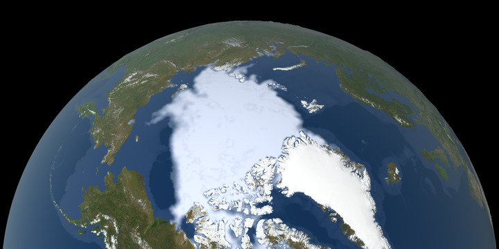
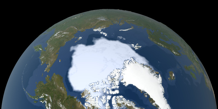
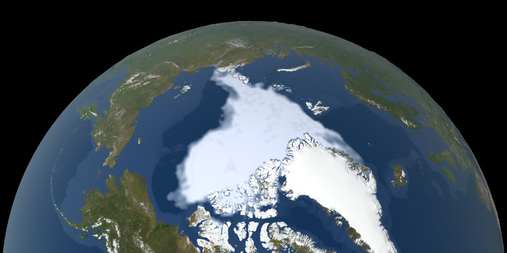
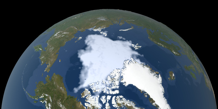
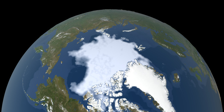
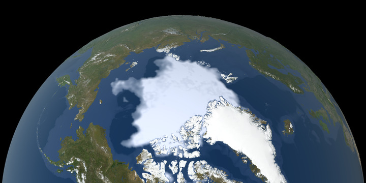
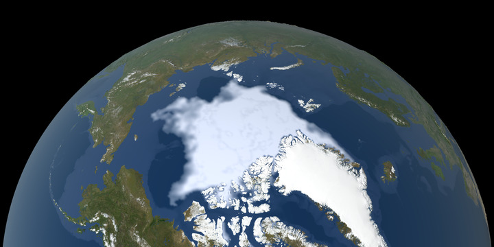
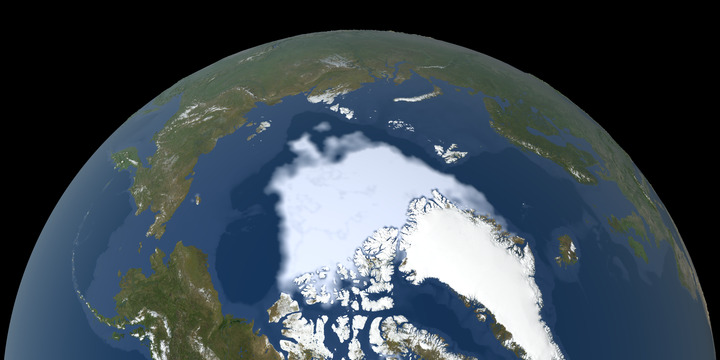
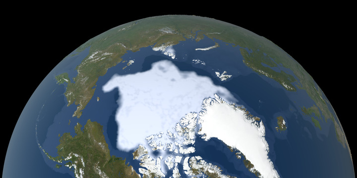
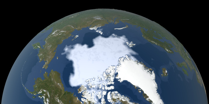
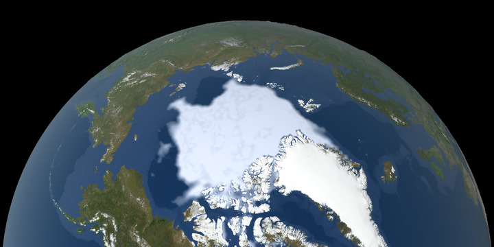
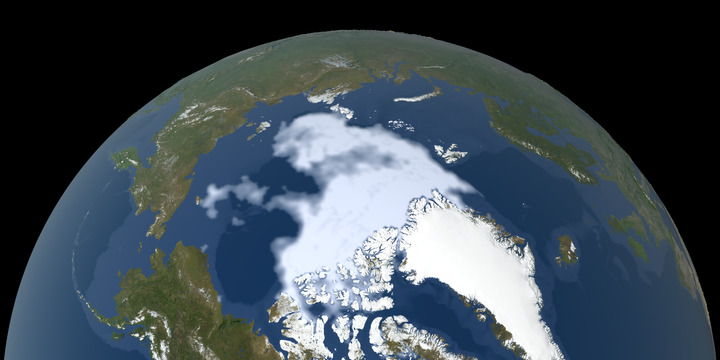
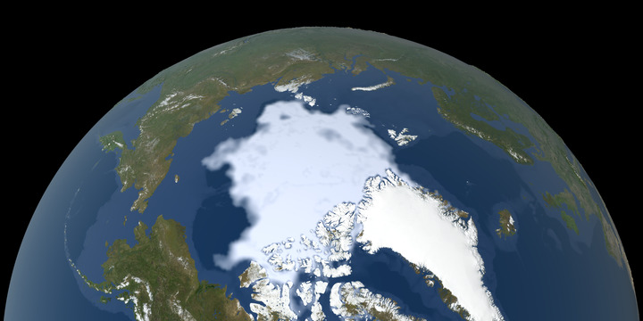
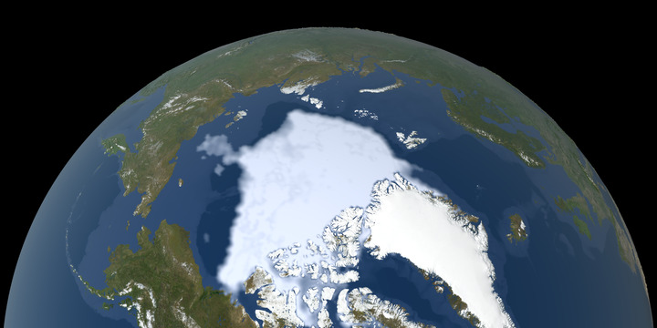
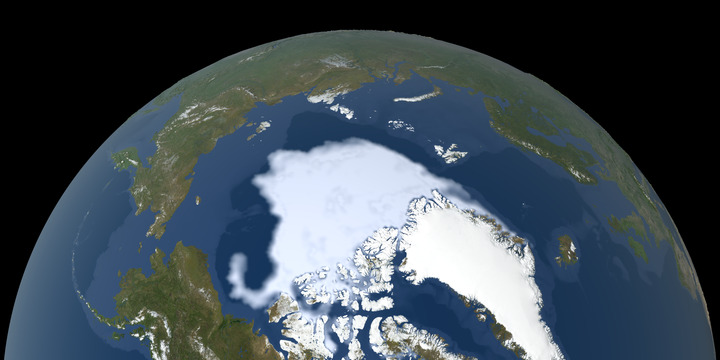
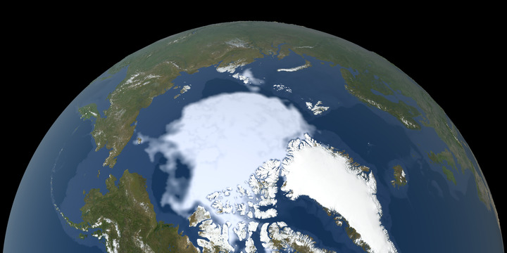
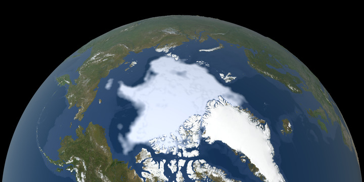
The animated map below shows the minimum size of the Arctic sea ice measured each year since 1979, based on satellite observations. The 2012 sea ice extent is the lowest in the satellite record.
Sea ice extent is one of three key sea ice metrics. Other measurements include:
- Arctic sea ice volume
- Arctic sea ice age
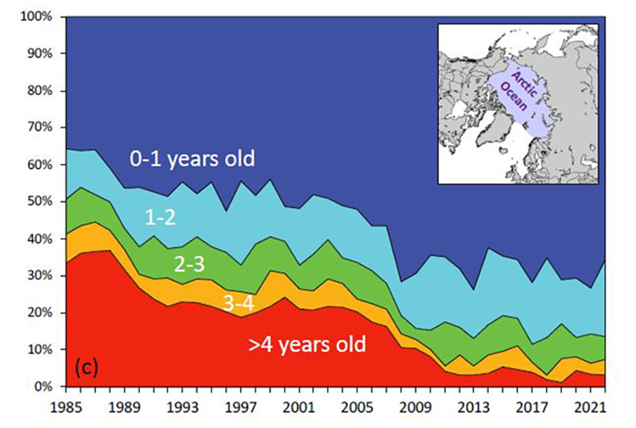
Sea ice age percentage within the Arctic Ocean for the week of 11-18 March 1985-2022. Credit: NOAA

The data shown are the latest available, updated annually.
Learn more:
ANNUAL SEPTEMBER MINIMUM EXTENT
Time Series: 1979-2022
Credit: NASA Scientific Visualization Studio