1
1. Where on Earth?

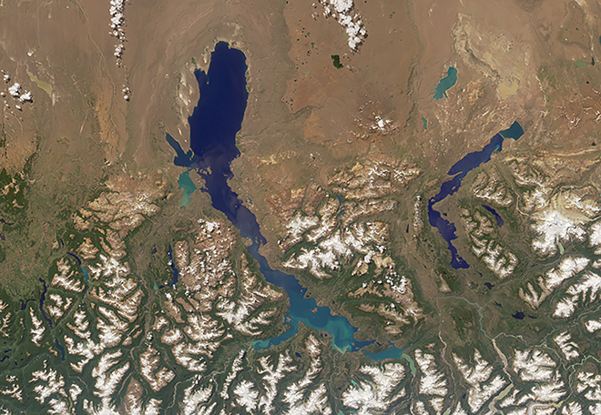
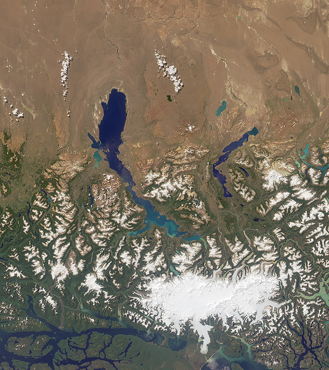
What country or countries are visible within this image?
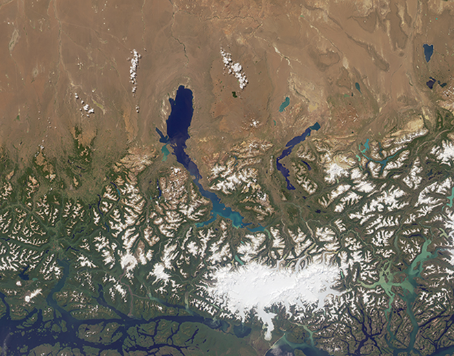
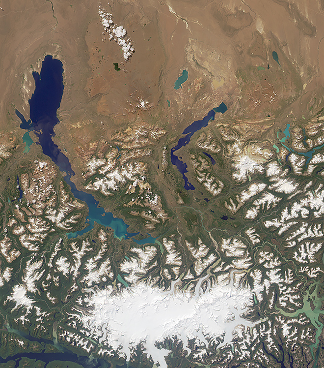
Two countries are visible in this image: Chile and Argentina. The border between them passes through the lake in the middle of the image.
The Multi-angle Imaging SpectroRadiometer (MISR) team at NASA is pleased to announce the reinstatement of their Where on Earth…? quizzes at their new home on NASA Climate! MISR has a long tradition of publishing these challenging geographical mysteries. The format has changed slightly from previous quizzes, so make sure to read the instructions below.
Here’s how it works: When you press “Start,” you will be presented with nine multiple-choice questions (one question for each of MISR's nine cameras) about the area seen in the image in the background. You are encouraged to research the answers using any websites or reference materials you like. You cannot go back to previous questions, so make sure of your answer before proceeding! If you answer all questions correctly, you will have a chance to enter for a prize. The deadline for prize entries is November 23, 2016, at 4:00 p.m. PST.
This natural color image was acquired by the vertical-viewing camera of the MISR instrument in January 2016 and represents an area of about 390 kilometers by 300 kilometers. Note that north is not necessarily at the top.
Archive of previous Where on Earth...? Quizzes
Glasser et al. study on ice age flooding of Lake Buenos Aires
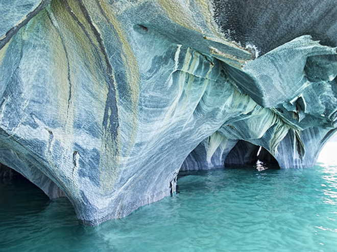
Trepando los Andes (Climbing the Andes) by Clemente Onelli
Smithsonian Global Volcanism Program entry on Cerro Hudson
Weller et al. study on ash layers from Cerro Hudson eruptions
Creative Commons Attribution-ShareAlike 2.0 Generic License
Creative Commons Attribution-Share Alike 3.0 Unported License
What country or countries are visible within this image?