Earth Pop Quiz

How much do you know about Earth and Earth-observing systems?

Take the quiz to find out.

More Info / References

1

1.

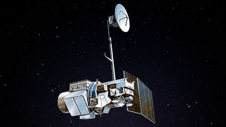
Which Earth-observing satellite holds the Guinness World Record for longest lifetime?

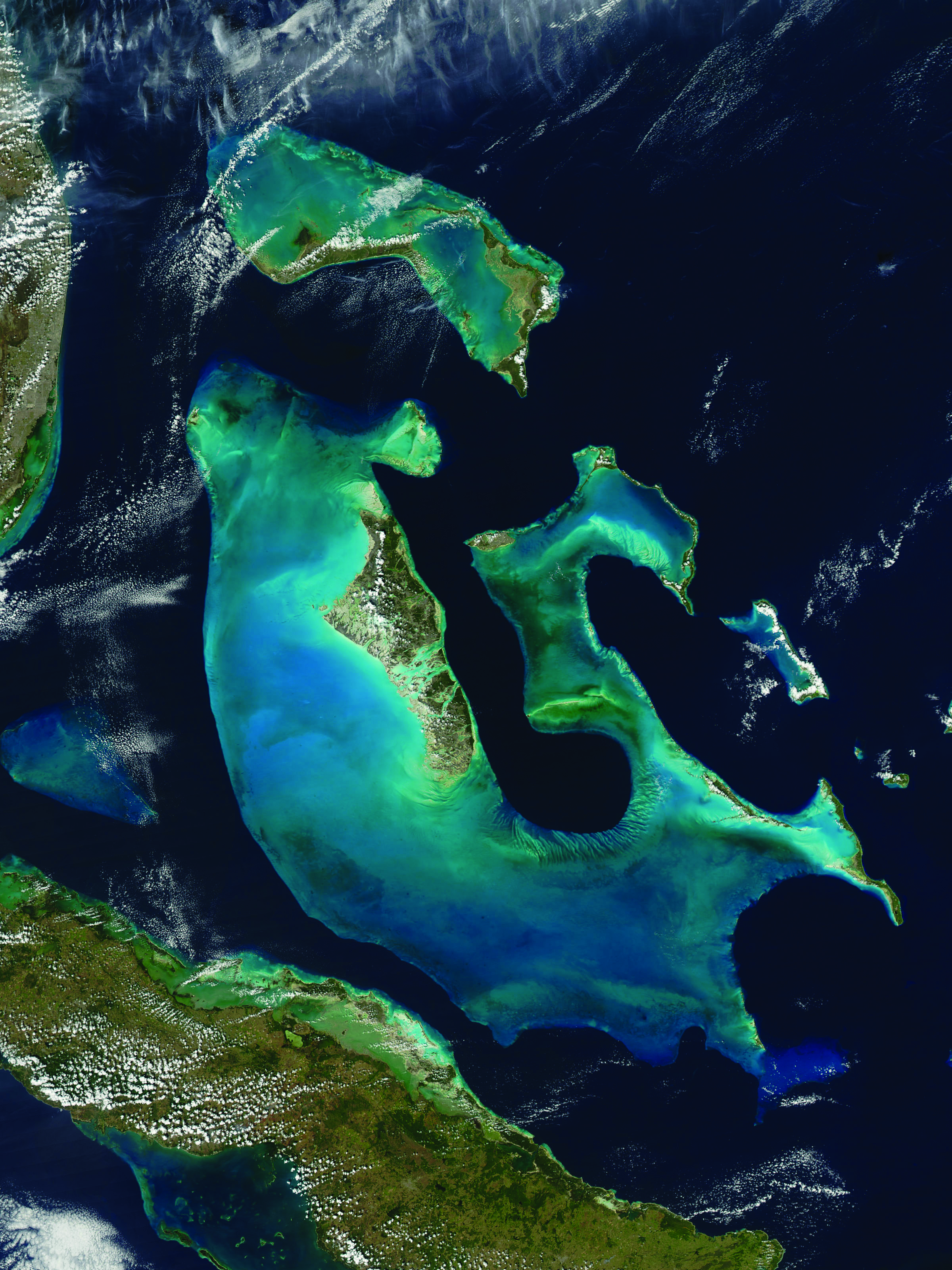
Landsat 5 provided operational imagery from 1984 t0 2011. It documented droughts, floods, volcanic eruptions, the clearing of rainforests, the greening of agricultural fields, and the influence of a human population that grew from less than 5 billion to more than 7 billion.
2

2.

On average, which of these natural disasters kills the most Americans annually?

Floods on average kill around 150-200 Americans each year—more than tornadoes, hurricanes, earthquakes, or lightning.
3

3.

The Mesopelagic Zone in the ocean is also called:

The Mesopelagic zone is a range of ocean depth that starts 650 feet below the water's surface to around 3,280 feet below the surface (200 to 1,000 meters).
4

4.

What was the name of the United States first satellite?

Explorer 1, the first U.S. satellite, was a joint project of the Army Ballistic Missile Agency in Huntsville, Alabama, which built the launch rocket; the Jet Propulsion Laboratory in Pasadena, California, which built the satellite; and the University of Iowa, where the science instruments were designed.
5

5.

This Aqua satellite image from 2009 shows Great Bahama Bank. The underwater terrain is hilly and the crests of many of these hills compose the islands of the Bahamas. What is often the water depth over the banks?

The waters of the Bahama Banks are very shallow. The limestone that comprises the Banks has been accumulating since at least the Cretaceous period.
6

6.

This Landsat image from 1999 shows Lake Carnegie, which fills with water only during periods of significant rainfall. Where is this ephemeral lake located?

Ephemeral Lake Carnegie fills with water only during periods of significant rainfall. In dry years, it is reduced to a muddy marsh.
7

7.

One hectare of seagrass is one of the most valuable ecosystems on the planet. What is its estimated worth over a year?

Seagrasses are found in shallow salty and brackish waters in many parts of the world, from the tropics to the Arctic Circle. Although they often receive little attention, they are one of the most productive ecosystems in the world.
8

8.

Which of the following is NOT true?

Gravity varies across the Earth. Did you know that you weigh about 0.5% more at the poles than on the equator? The shape of the Earth affects so many different things, such as buying a house, the construction of roads and highways, storm evacuation routes, and much more. Gravity, and the shape of the earth, is measured though bench marks set in the ground by the National Geodetic Survey (NGS), by satellites such as GRACE FO (Gravity Recovery and Climate Experiment Follow-On), and by aircraft through the Gravity for the Redefinition of the American Vertical Datum (GRAV-D) project.
9

9.

What kind of Earth-observing instrument measures vertical distributions of atmospheric parameters such as temperature, pressure, and composition from multispectral information?

For example, the Atmospheric Infrared Sounder (AIRS) is a facility instrument whose goal is to support climate research and improve weather forecasting. AIRS is one of six instruments onboard Aqua, which is part of NASA's Earth-observing system of satellites.
10

10.

What is the main objective of USGEO?

The U.S. Group on Earth Observations (USGEO) is a subcommittee of the White House Office of Science and Technology Policy’s Committee on Environment. USGEO leads U.S. federal efforts to enable a healthy public, environment, and planet through integrated, comprehensive, and sustained Earth observations. USGEO also supports the international organization, the Group on Earth Observations (GEO).