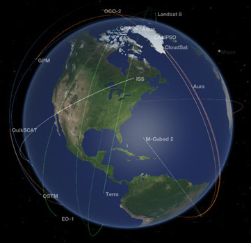
Earth Pop Quiz

How much do you know about Earth and Earth-observing systems?

Take the quiz to find out.

More Info / References

1

1.

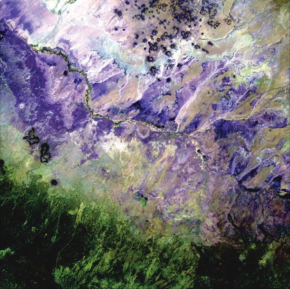
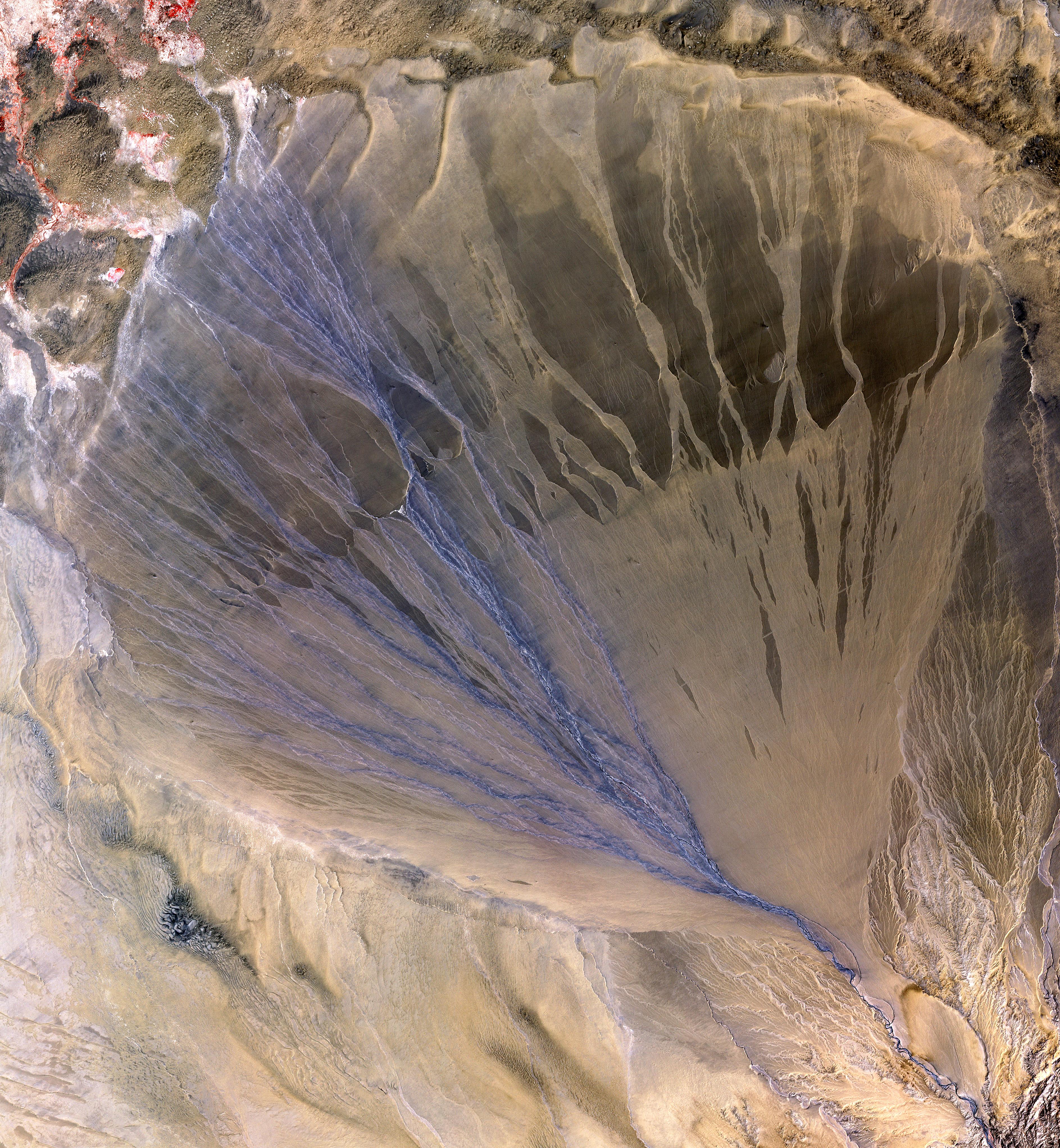
This 2009 Landsat image of northeast Arizona, U.S.A., shows a long expanse of arid, erosion-prone, austere badlands made of multicolored mudstones and clays. What is the common name of this geographic area?

The Painted Desert stretches from the Grand Canyon in the northwest, to the Petrified Forest National Park in the southeast.
2

2.

What is the name of this geologic feature?

An alluvial fan is a fan-shaped or cone-shaped deposit of sediment crossed and built up by streams and rivers.
3

3.

What is in this image?

Formed by the merger of several smaller glaciers, the Chapman Glacier is located on Ellesmere Island, Nunavut Territory, Canada, near the North Pole.
4

4.

Which type of air pollution is the most difficult to measure from space?

Ground-level ozone is not directly measurable from space because of the abundance of ozone higher in the atmosphere, which obscures measurements of surface ozone. Ozone at ground level is a harmful air pollutant because of its effects on people and the environment; and it is the main ingredient in “smog." You can check ozone levels and other daily air quality information by visiting www.airnow.gov which is led by the EPA.
5

5.

This Landsat image from 2003 shows Dasht-e Kavir, or the Great Salt Desert. Where is this mixed landscape of salt marshes, mudflats, wadis, steppes, and desert plateaus located?

The Dasht-e Kavir is in north-central Iran. Located in a basin southeast of the Elburz Mountains, it is approximately 240 miles (390 km) wide.
6

6.

Select the true statement(s)

The impacts of space weather can have serious economic consequences. Geomagnetic storms during the 1990s knocked out several telecommunications satellites, which had to be replaced at a cost of about $200 million each.
7

7.

Who made the first meteorological satellite?

NASA considers the first meteorological satellite to be TIROS 1, launched April 1, 1960. The Television InfraRed Observational Satellite, or TIROS 1, operated for only 78 days but demonstrated the feasibility of monitoring Earth's cloud cover and weather patterns from space. This NASA program provided the first accurate weather forecasts based on data gathered from space.
8

8.

About how many active satellites are currently in orbit around the Earth?

There are about 1,100 active satellites, both government and private, currently in Earth orbit. Plus, there are about 2,600 ones that no longer work!
9

9.

The solar wind continuously flows outward from the Sun and consists mainly of protons and electrons in a state known as a plasma. The solar magnetic field is embedded in the plasma and flows outward with the solar wind. Which of the following spacecraft provide in-situ measurements of the solar wind?

Located about a million miles away from Earth, DSCOVR is located at the L-1 Lagrangian point between Earth and the Sun and provides advanced warning of the solar wind which can affect power grids, communications systems, and satellites close to Earth.
10

10.

What is the main objective of USGEO?

The U.S. Group on Earth Observations (USGEO) is a subcommittee of the White House Office of Science and Technology Policy’s Committee on Environment. USGEO leads U.S. federal efforts to enable a healthy public, environment, and planet through integrated, comprehensive, and sustained Earth observations. USGEO also supports the international organization, the Group on Earth Observations (GEO).