News | March 15, 2012
End of winter: How 2012 snow stacks up
By Ellen Gray,
NASA's Goddard Space Flight Center
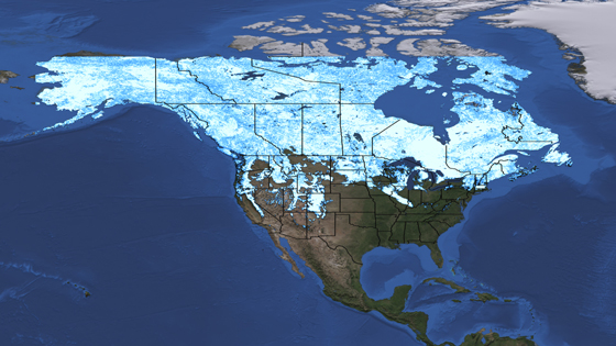
The mild winter of 2012 has many people asking, "Where's the snow?" These two snow cover maps show the difference between snow extent on March 3, 2011, and March 5, 2012. The maps were compiled from data collected by the Moderate Resolution Imaging Spectroradiometer (MODIS) instrument aboard NASA's Terra satellite.
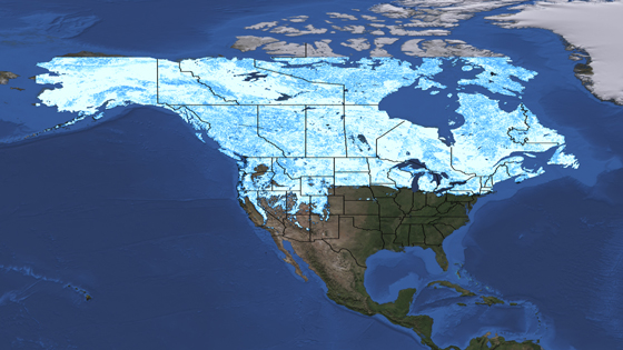
In 2012, the snow cover is very spotty compared to 2011. In 2011, the Great Lakes were clearly defined by surrounding snow, and snow blanketed the Rocky Mountains, Nevada's Basin and Range, and the Sierra Nevada all the way into southern California.
In 2012, areas that are usually snow covered are bare, including parts of Montana, Wyoming and South Dakota. The Snake River Plain in southern Idaho is clearly visible. This low-lying valley is the track of the hotspot that is now under Yellowstone National Park. In the east, the Great Lakes area, southern Ontario and the East Coast of the United States have much less snow cover than they did at this time last year.
2012's relatively light snowfall is the result of two atmospheric processes, according to climatologist Bill Patzert of NASA's Jet Propulsion Laboratory, Pasadena, Calif. One is the La Niña conditions in the Pacific, which result in less moist air crossing the continental United States. The other is a strong Arctic Oscillation that keeps cold arctic air around the North Pole and away from more southern latitudes.