News | March 22, 2022
Arctic Sea Ice Maximum at Tenth Lowest in Satellite Record
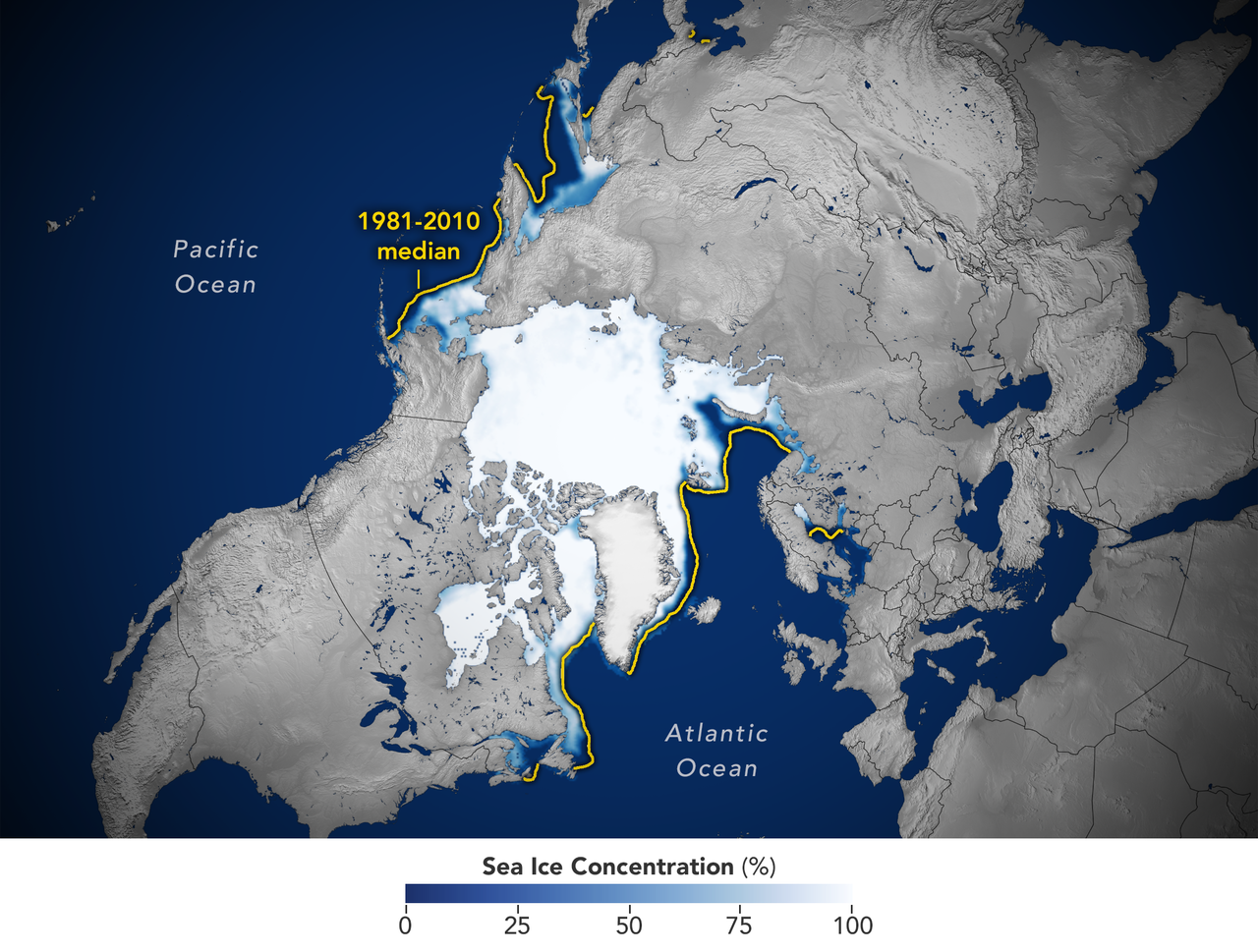
This image shows the average concentration of Arctic sea ice on Feb. 25, 2022. The yellow outline shows the median sea ice extent for the month of March, when the ice generally reaches its maximum extent, as observed by satellites from 1981 to 2010. A median is the middle value. That is, half of the extents were larger than the line, and half were smaller. Credit: Joshua Stevens/NASA Earth Observatory
On February 25, 2022, Arctic sea ice likely reached its maximum extent for the year, coming in at the tenth lowest in the satellite record.
The wintertime extent peaked at 5.75 million square miles (14.88 million square kilometers) and is roughly 297,300 square miles (770,000 square kilometers) below the 1981-2010 average maximum – equivalent to missing an area of ice slightly larger than Texas and Maine combined. This maximum ties with 2015 as the third earliest on record.
Read the full analysis at https://nsidc.org/arcticseaicenews/2022/03/arctic-sea-ice-max-tenth-lowest/.


