4 min read
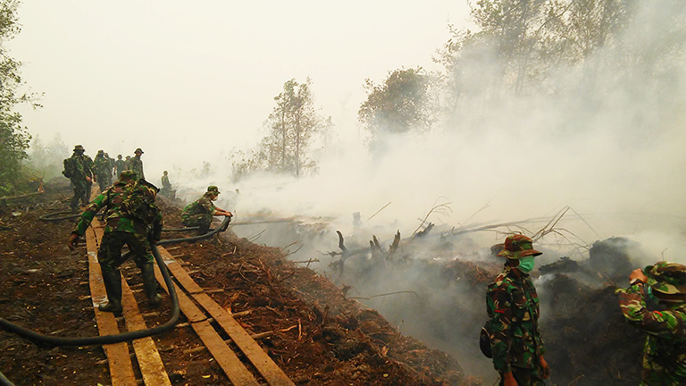
For many people, the term El Niño foretells a cyclical weather pattern that brings increased rainfall and more intense storms. But not every place on Earth responds to El Niño with wetter conditions. In some locations, like Indonesia, the change in ocean temperatures and atmospheric patterns brought about by El Niño has the opposite effect—shifting thunderstorms eastward and causing extremely dry conditions. In 2015, this "drying out" effect triggered one of the most severe fire seasons on record in Indonesia.
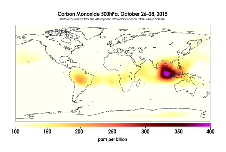
“For Indonesia burning, it was the most significant event that we’ve seen during the 15-year satellite record,” according to Robert Field, a Columbia University research scientist at the NASA Goddard Institute for Space Studies who specializes in climate modeling and fire science. “The smoke plume stretched halfway around the world at the equator, and the fire-prone areas were blanketed in really thick smoke for six to eight weeks continuously.”
Aside from the destruction caused by the burning, the fires wreaked havoc on local and regional air quality. By early September, six Indonesian provinces had declared a state of emergency due to the haze caused by carbon monoxide and other gas pollutants emitted during burning. “You have hazardously high air pollution levels without a break, and it impacts the entire Southeast Asia region, including Singapore, west Malaysia and southern Thailand,” Field said.
And, Field said, there’s a "wild card" in Indonesia that intensifies fire events—the peatlands. Indonesian forests are home to roughly 60 percent of the world’s tropical peatlands, where decayed vegetation or organic matter has accumulated in the soil layers and created peat deposits that can be up to 10 meters deep. “Once these fires get underground into the peat, they don’t stop burning until the seasonal rains return, and that happens later during El Niño episodes,” Field said. “They just burn and burn and produce smoke continuously, and they can’t be put out through conventional fire-fighting.”
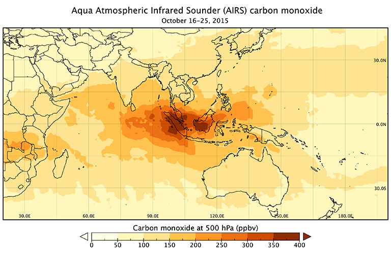
Field and his colleagues analyzed data from the Atmospheric Infrared Sounder (AIRS) and four other satellite instruments, along with airport visibility records, to understand the drought conditions under which the 2015 fires in Indonesia occurred. By looking at carbon monoxide levels, aerosol quantities and thermal signatures from active fires, they were able to not only track the event while it happened, but also frame it within the context of previous fire episodes in the 15-year satellite record. “AIRS was my go-to data source for monitoring the extent of the smoke plume during the Indonesian fire event,” Field said. “Along with the other measurements we looked at, AIRS data gave us a full picture of the impacts of these fires.”
The analysis also enabled the team to identify a seasonal rainfall threshold—a baseline above which conditions are too wet to permit any burning. “When you get below this threshold, the peat has enough time to dry out under the very hot equatorial conditions,” Field said. “And the further below that threshold you go and the longer the dry season, the more fire you see.”
The correlation between the rainfall threshold and increased fire activity was evident across all satellite data used in the study, which makes the threshold a useful benchmark for predicting and preparing for potential fire episodes. “Because the influence of El Niño on Indonesian rainfall is so direct, we can increasingly anticipate these conditions in advance, so the rainfall threshold is a red flag and gives us an early warning system,” Field said. “It’s a bit like a freight train, and we can see it coming.”

