News | September 1, 2008
Arctic sea ice now second-lowest on record
According to an update on the center's website, the next several weeks will determine whether 2008 will break the standing record low, set in 2007.
The center website posts the following additional information:
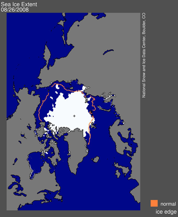
"With several weeks left in the melt season, sea ice extent dipped below the 2005 minimum to stand as the second-lowest in the satellite record. The 2005 minimum, at 5.32 million square kilometers (2.05 million square miles), held the record-low minimum until last year."
The Arctic sea ice extent on August 26 was 5.26 million square kilometers (2.03 million square miles), a decline of 2.06 million square kilometers (795,000 square miles) since the beginning of the month. Extent is now within 430,000 square kilometers (166,000 square miles) of last year's value on the same date and is 1.97 million square kilometers (760,000 square miles) below the 1979 to 2000 average, according to the center website.
The National Snow and Ice Data Center (NSIDC) is part of the Cooperative Institute for Research in Environmental Sciences at the University of Colorado at Boulder and is supported in part by NASA, NOAA, the National Science Foundation and others.