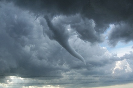
Extreme Weather

An extreme weather event is something that falls outside the realm of normal weather patterns. It can range from a flood to a drought to a hurricane to a hailstorm. How much of a freak-weather freak are you?

1

1. STORM FORCE

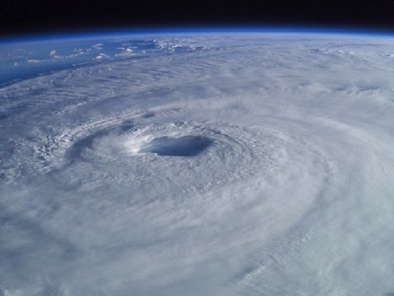
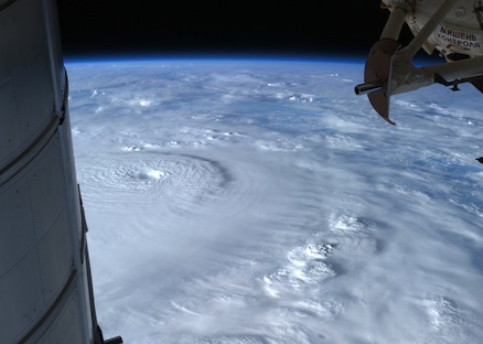
Hurricanes can result in extensive property damage, especially when a storm’s intensity is poorly forecast and people don’t have a chance to prepare. A storm’s intensity can be difficult to predict because:

Hurricane forecasters strive to predict where a storm is heading and how strong it will be. Since the early 1990s, they have significantly improved forecasts of hurricane paths in the Atlantic basin by about 2 to 4 percent a year. But forecasts of hurricane intensity have improved more slowly—by less than 1 percent a year in the Atlantic Ocean basin since the mid-1980s and even less in the east and west North Pacific basin. How a storm intensifies can be strongly influenced by a number of factors that are difficult to measure very accurately over the oceans, including vertical shear (how winds vary with height), humidity and change in atmospheric stability. This difficulty leads to less-precise forecasts.
2

2. WHAT ARE YOU LOOKING AT?

Which of these is a difference between tornadic waterspouts and fair-weather waterspouts?

Tornadic waterspouts have the same characteristics as land tornadoes, and in fact often begin over land. Fair-weather waterspouts are much more common. They form only over water and usually in light wind conditions. Though less dangerous than the tornadic variety, they should still be avoided. Waterspouts usually develop over warm tropical ocean waters, and are spotted in the Florida Keys more than any other place in the world. They are also seen over the waters of the Great Lakes from August through October, when cold air moves across the warm waters.
3

3. THUNDER DOME

The tops of severe thunderstorm clouds can reach altitudes as high as:

Extreme thunderstorms form in areas where the air is unstable—that is, where rising volumes of air remain warmer and less dense than the surrounding air and so continue to rise. (Where air is stable, a volume of air that is warmer than the surrounding air will rise until it either achieves equilibrium with the surrounding air and stops, or becomes colder and denser than the surrounding air and sinks back down.) This instability helps create strong currents of rising air (updrafts) that can penetrate the lowest part of Earth’s atmosphere (the troposphere) and the next layer up (the lower stratosphere). Strong updrafts can cause thunderstorms with large hailstones, tornadoes, heavy rainfall and lightning. Thunderstorm cloud tops have been seen more than 12 miles (20 kilometers) high by NASA’s Tropical Rainfall Measuring Mission (TRMM) and Cloud-Aerosol Lidar and Infrared Pathfinder Satellite Observation (CALIPSO) satellites.
4

4. SPIN CYCLE

Hurricanes, flushing toilets and draining bathtubs swirl counterclockwise in the Northern Hemisphere and clockwise in the Southern Hemisphere.

When objects move northward or southward, Earth’s rotation tends to deflect them to the right in the Northern Hemisphere and to the left in the Southern hemisphere. This is known as the “Coriolis effect.” It makes hurricanes spin counterclockwise north of the equator and clockwise south of the equator. But the effect is weak and doesn’t show up at the scale of ordinary toilets and bathtubs, where various plumbing factors have much greater influence on which way the water swirls.
5

5. A RIVER RUNS ABOVE IT

Which of the following is NOT true about atmospheric rivers (ARs)?

Atmospheric rivers are relatively narrow regions in the atmosphere (on average, about 250 to 370 miles, or 400 to 600 kilometers, wide) where large amounts of water vapor flow. Most are weak and provide beneficial rain or snow, but the largest ones can create extreme rainfall and flooding. On average, about 30 to 50 percent of the annual precipitation in the West Coast states occur in just a few AR events.
6

6. DESERT STORM

NASA’s Hurricane and Severe Storm Sentinel (HS3) is a five-year robotic-aircraft mission to investigate the processes that underlie hurricane formation and intensity change in the Atlantic Ocean basin. One target of its research is the Saharan Air Layer (SAL). Which of the following is true about the SAL?

The SAL’s dry air can weaken a tropical cyclone by promoting downdrafts around the storm, while its strong winds can substantially increase the vertical wind shear in and around the storm environment. It is not yet clear what effect the SAL's dust has on tropical cyclone intensity, though some recent studies have suggested that it can actually impact the formation of clouds. The SAL can cover an area the size of the continental U.S. and has been tracked as far west as the Caribbean Sea, Central America and the Gulf of Mexico.
7

7. FUNNEL FACTS

What is a funnel cloud?

There are two types of funnel clouds. Cold-air funnels usually form when showers develop under certain atmospheric conditions. They rarely touch the ground. However, when funnels develop in thunderstorms, they are more likely to descend to the ground, becoming tornadoes. Tornadoes are extreme weather events associated with damaging wind speeds. The strength of a tornado is categorized by the Enhanced Fujita Scale, based on the damage it causes. Scientists and weather forecasters can forecast, track and study severe weather events such as tornadoes through a combination of satellite and ground-based-radar observations.
8

8. BLOW HARDS

What is the difference between a hurricane, a cyclone and a typhoon?

They are different names for the same phenomenon. “Hurricane” is used for storms in the Atlantic and Northeast Pacific, “cyclone" is used for storms in the South Pacific and Indian Ocean and “typhoon” is used for storms in the Northwest Pacific.
9

9. FIRE WHEN READY

“Fire weather” indicates how likely a wildfire is to start, how rapidly it would spread and how difficult it would be to extinguish. Which of these factors make for dangerous fire weather?

Fire weather is the result of a combination of meteorological quantities used to assess the potential for extreme fires, which can occur when there is an ignition (such as lightning) and fuel (dry vegetation) available to burn. This information is used to help firefighters and communities prepare for fires, and by forest managers who might want to set a controlled burn when fire-weather conditions are low to reduce the amount of fuel that would be available to a wildfire. Global warming is a major contributing factor to wildfire risk. The hotter and drier conditions that it can bring lead to longer fire seasons and more fuel for wildfires.
10

10. WHAT'S IN A NAME?

What does the prefix "nimbo-" or postfix "-nimbus" mean when attached to a cloud name—for example, “nimbostratus” or "cumulonimbus?"

Clouds form when water droplets condense onto tiny particles (sea salt, dust, clay, black carbon, soot) called nuclei. Depending on temperature and height, clouds can also contain ice crystals and "supercooled" (sub-freezing-temperature) water. When enough cloud droplets collide and join together, they become too heavy to stay aloft and fall to the Earth as rain or snow.