News | June 28, 2016
NASA maps California drought effects on Sierra trees
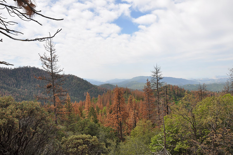
Dead and dying ponderosa (Pinus ponderosa) and sugar (P. lambertiana) pine on the Hume Lake Ranger District, Sequoia National Forest, California. Credit: USDA Forest Service.
A new map created with measurements from an airborne instrument developed by NASA’s Jet Propulsion Laboratory, Pasadena, California, reveals the devastating effect of California’s ongoing drought on Sierra Nevada conifer forests.
The map will be used to help the U.S. Forest Service assess and respond to the impacts of increased tree mortality caused by the drought, particularly where wildlands meet urban areas within the Sierra National Forest.

The image was created by scientists at the USFS’s Pacific Southwest Region Remote Sensing Lab, McClellan, California, by performing a time series analysis of AVIRIS images. Scientists evaluated baseline tree mortality on public lands in the summer of 2015 using a machine learning algorithm to classify the AVIRIS measurements as dominated by either shrubs, healthy trees or newly dead conifer trees.
To quantify how much the amount of dead vegetation increased during the fall of 2015, the Forest Service scientists conducted an advanced spectral mixture analysis. This analysis evaluates each spectrum to determine the fraction of green vegetation, dead vegetation and soil. The full spectral range of AVIRIS is important to separate the signatures of soil and dead vegetation. To produce this comprehensive Sierra National Forest tree mortality map, the result from the summer of 2015 was evaluated to look for increases of more than 10 percent in dead vegetation during the fall of 2015.
“Reliable and current information is important to address public safety issues,” said Carlos Ramirez, program manager of the USFS’s Remote Sensing Lab in McClellan. “Right now, mapping tree mortality ‘hot spots’ near population centers is the most critical use of the imagery. Computing accurate estimates to meet this need would not be possible without the imaging data acquired by AVIRIS.”
AVIRIS measures spectra of the Earth system to conduct advanced science research. These western U.S. AVIRIS measurements were acquired as part of NASA’s Hyperspectral Infrared Imager (HyspIRI) preparatory airborne campaign. HyspIRI was one of the space missions suggested to NASA by the National Academy of Sciences in its 2007 decadal survey for Earth Science. In the future, HyspIRI could provide spectral and thermal measurements of this type globally for ecosystem research and additional science objectives.
AVIRIS data are available for download and are being used for a range of additional science investigations.
For more on AVIRIS, visit:
http://airbornescience.jpl.nasa.gov/campaign/aviris
For more on HyspIRI, visit:
For more on NASA's Airborne Science Program, visit:
http://airbornescience.nasa.gov/
For more information about NASA's Earth science activities, visit:
Media contact
Alan Buis
Jet Propulsion Laboratory, Pasadena, Calif.
818-354-0474
alan.buis@jpl.nasa.gov


