Ask NASA Climate | March 6, 2012, 16:00 PST
The streets
Clouds around Greenland
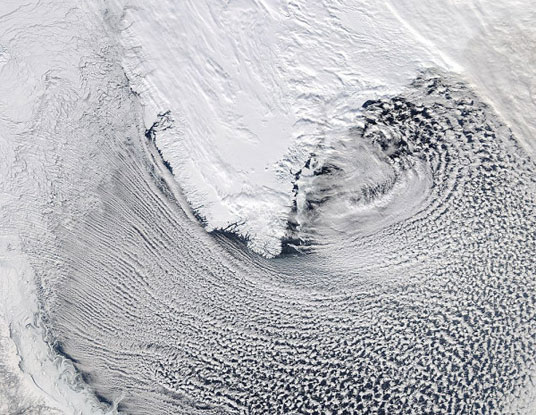
Cloud streets around southern Greenland. Image taken by NASA's MODIS (Moderate Resolution Imaging Spectroradiometer) instrument onboard the Aqua satellite.
This image shows impressive cloud "streets" around southern Greenland. Cloud streets are bands of cumulus clouds that form parallel to the low-level wind direction under the right conditions. They usually form within the lower one to three kilometers of the atmosphere, known as the planetary "boundary layer," and are caused by convection. They can form over land or sea. Under the right conditions, cloud streets exhibit remarkable periodic patterns. Airplanes — or space satellites — can offer especially good views.
Thanks to NASA's Earth Observatory twitter feed for the heads-up on this new image!