Ask NASA Climate | July 21, 2010, 17:00 PDT
Pick of the pics
Adrift at sea
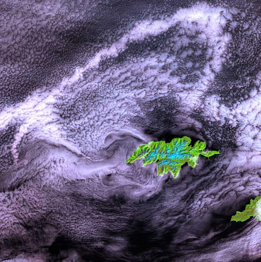
Image and caption courtesy of the Landsat mission, which is managed by NASA and the U.S. Geological Survey.
This pic of Attu Island, in the Western Aleutian Islands, was taken by the Landsat-7 satellite on July 27, 2000. As the westernmost point in North America, Attu is a rugged island dominated by snow-covered mountains. It is 20 by 35 miles in size (32 by 56 kilometers) and lies at the far western end of the Aleutian chain, approximately 1100 miles (1770 kilometers) from the Alaskan mainland and 250 miles (402 kilometers) from the Siberian coastline. The weather is characterized by persistently overcast skies, fog, high winds and frequent cyclonic storms.
The Japanese invaded and occupied Attu in June 1942. Today, the island is home to a U.S. Coastguard station and is a sanctuary to many of North America's rarest birds.