Ask NASA Climate | January 13, 2010, 16:00 PST
Pick of the pics
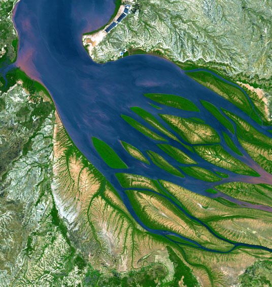
Bombetoka Bay, Madagascar
Courtesy of NASA/Goddard Space Flight Center, Japan's Ministry of Economy, Trade and Industry, Japan's Earth Remote Sensing Data Analysis Center, the Japan Resources Observation System, and the U.S./Japan ASTER Science Team.
This image of Bombetoka Bay in northwestern Madagascar was taken in August 2000 by NASA’s Advanced Spaceborne Thermal Emission and Reflection Radiometer (ASTER) instrument. Bombetoka Bay is an inlet of the Mozambique Channel, which separates Madagascar from Africa to the west. In the picture, water is sapphire and tinged with pink where sediment is particularly thick. Dense vegetation can be seen in deep green.
Just downstream is the second largest port of Madagascar — the town of Mahajanga — a road terminus and trade center that exports among other things sugar, coffee, spices, timber and vanilla. The surrounding area contains extensive coffee plantations.